
Vifilsfell Hike: Trail and What to Expect
Hike Overview
Vifilsfell Hike: Trail and What to Expect
What Is Vífilsfell?
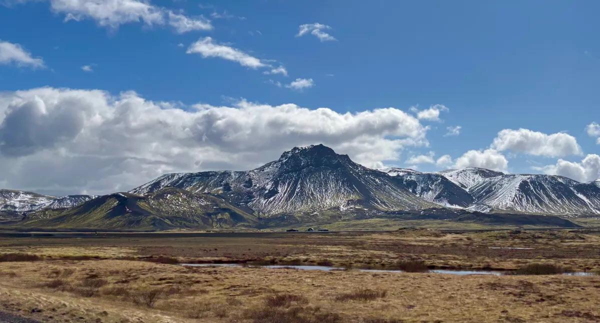
Vífilsfell is a prominent mountain in the highlands on the way from Reykjavik to Hveragerði. Its sharp, distinct profile makes it a recognizable landmark from Reykjavik and a highly sought-after destination for hikers.
Because it is located less than a 30-minute drive from downtown Reykjavik, Vífilsfell is a very accessible hiking destination. It offers the ruggedness and steep ascents of remote Highland peaks but without the long travel time. Its shape comes from volcanic activity, where magma erupted beneath a glacier during the Ice Age. This geological origin gave Vífilsfell its steep, jagged ridges and loose slopes, making the hike both visually striking and physically demanding.
Getting to the Vifilsfell Trailhead
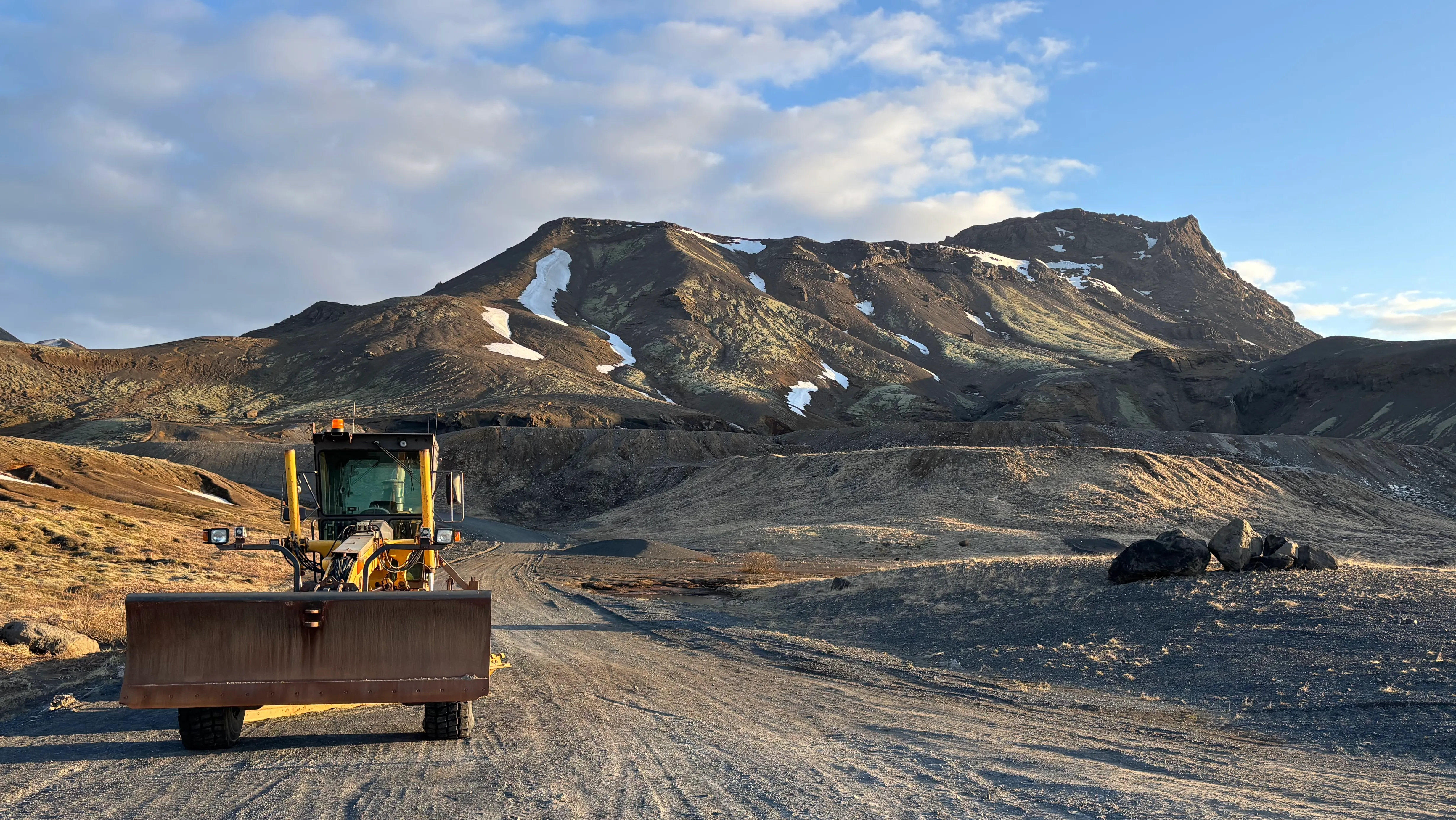 The trail starts on the dirt road
Access Routes and Transportation
Reaching the Vífilsfell trailhead from Reykjavik is straightforward by car. You will need to take Route 1 (the Ring Road) heading south towards Hveragerði, then turn onto the unpaved road Sandskeið, which leads closer to the base of the mountain.
The dirt road leading to the trailhead is short and generally passable for 2WD vehicles during the summer, but a 4WD is highly recommended, especially after heavy rain. In winter, spring, and late autumn, snow or mud can make the final stretch difficult.
Public transport does not connect directly to the starting point.
Parking Lot and Starting Point
There is a designated, unpaved parking area in front of the bar gate that leads to a work area. This parking serves as the official starting point for the hike. However, the mountain itself starts after about a 20-25 minute walk on the road after the gate.
Be aware that there are no facilities, restrooms, or water stations at the parking lot or anywhere along the trail. You must bring everything you need.
Trail Details and Route Description
Route and Path Description
The first 2km of the route are on a flat dirt road that leads from the parking lot to the mountain.
The trail then quickly begins to ascend rather steeply. The path is marked and well-trodden. It’s mostly loose scree and good shoes are required.
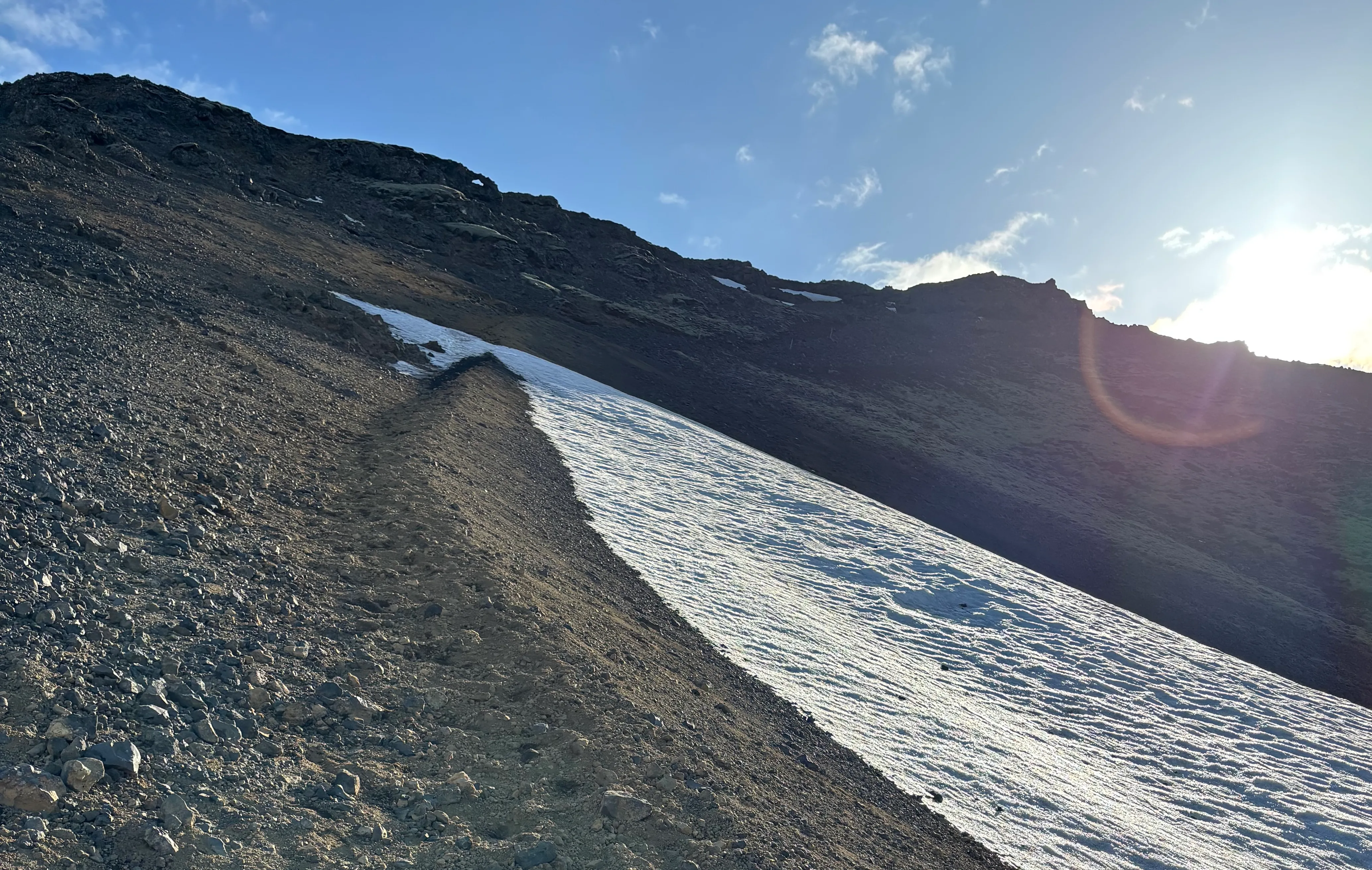 Steep scree slope of Vifilsfell
The path than changes to exposed tuff rock. There are still some wooden poles marking the trail but they aren’t too visible. There isn’t a single way up and most of it requires scrambling (i.e. don’t shy away from using your hands). The rock is stpp and there is significant exposure. That’s what makes this trail hard.
Once you reach the ridge, the way to the top is on your right. Again, the trail isn’t too visible as it’s mostly bare rock. Look for fixed ropes - you’ll need to use them to reach the top.
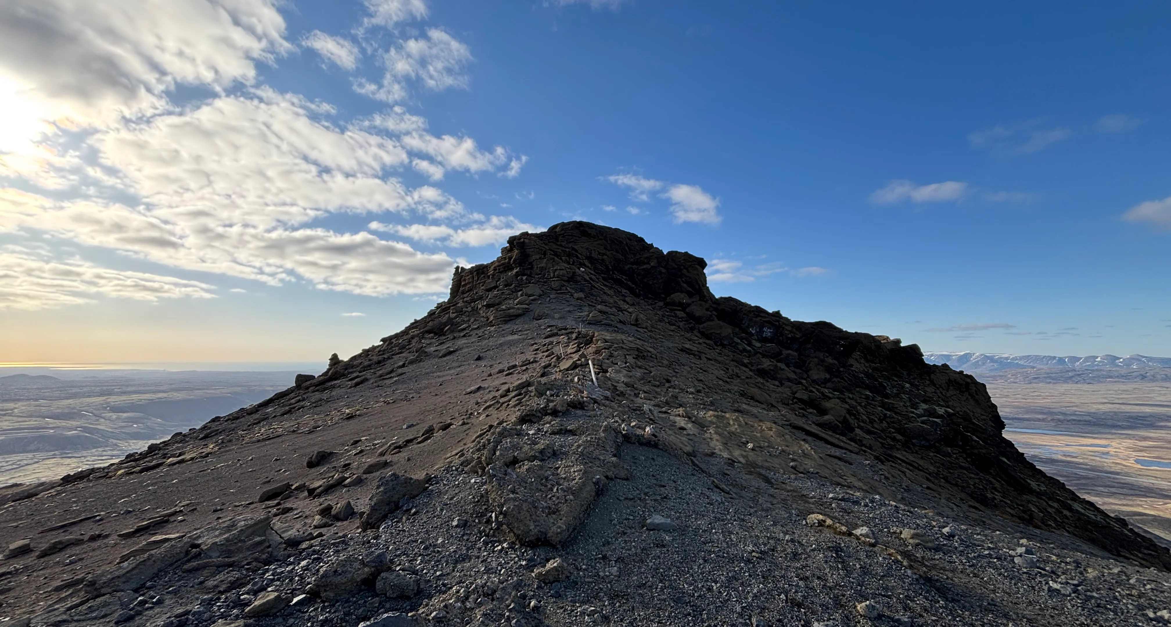 The final stretch of the hike before the fixed ropes on the way to the Vifilsfell summit.
The summit is a nice plateau, from where on a clear day you get a great view across all 360 degrees. If the summit is in the cloud, it’s best to skip it. The trail down might be hard to see and there is lots of exposure.
Trail Markers and Navigation
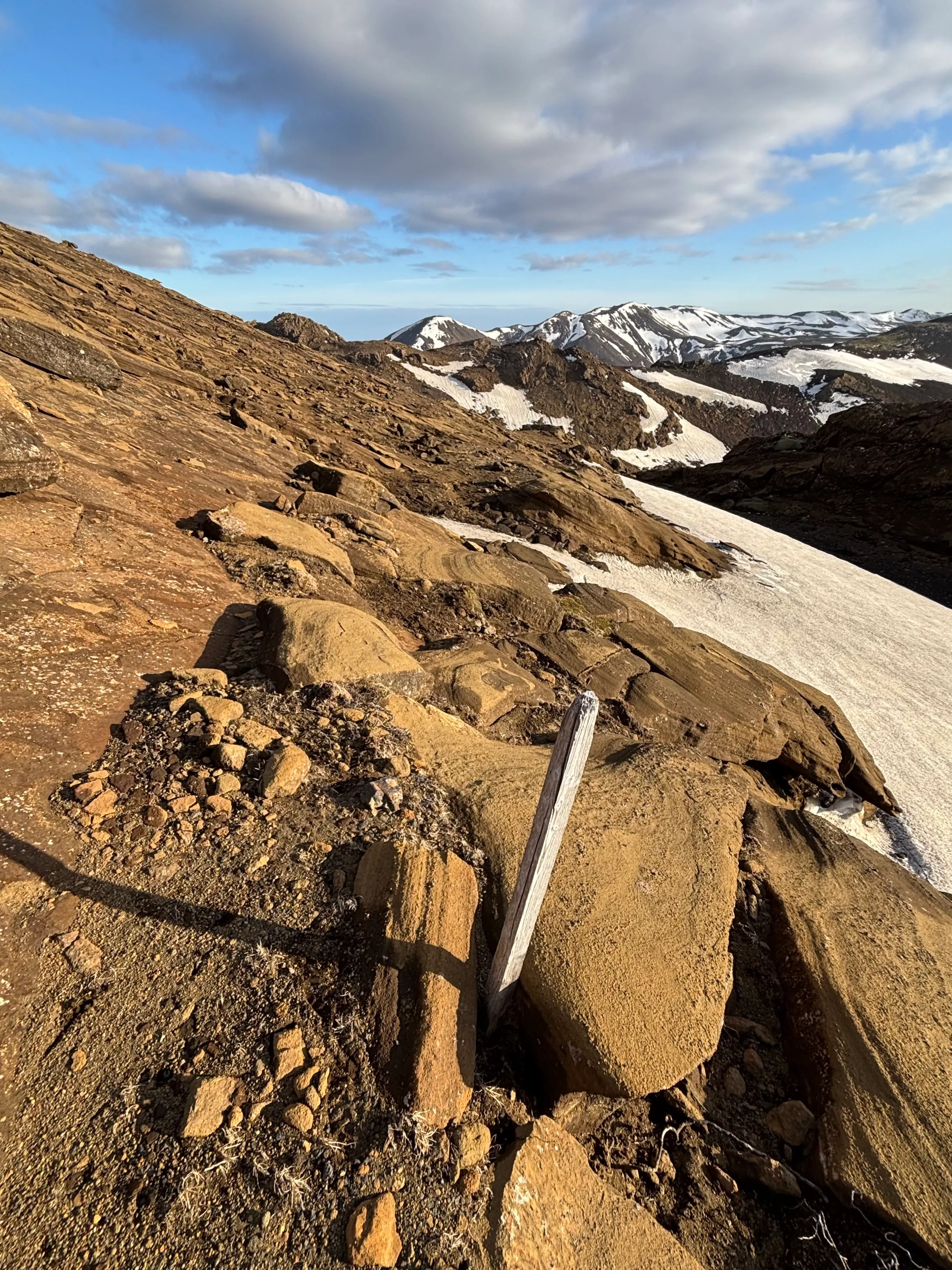 Scrambling up on the Vifilsfell hike
The trail up Vífilsfell is generally well-trodden and has some trail markers (often yellow posts or painted rocks). But they can be hard to spot in certain sections, especially during bad weather. The initial approach is easy to follow, but as you hit the steeper, rockier sections of the ridge, the path splits into multiple faint trails carved.
While the summit is almost always in sight on a clear day, using a GPS map or a reliable navigation hiking map app is highly recommended.
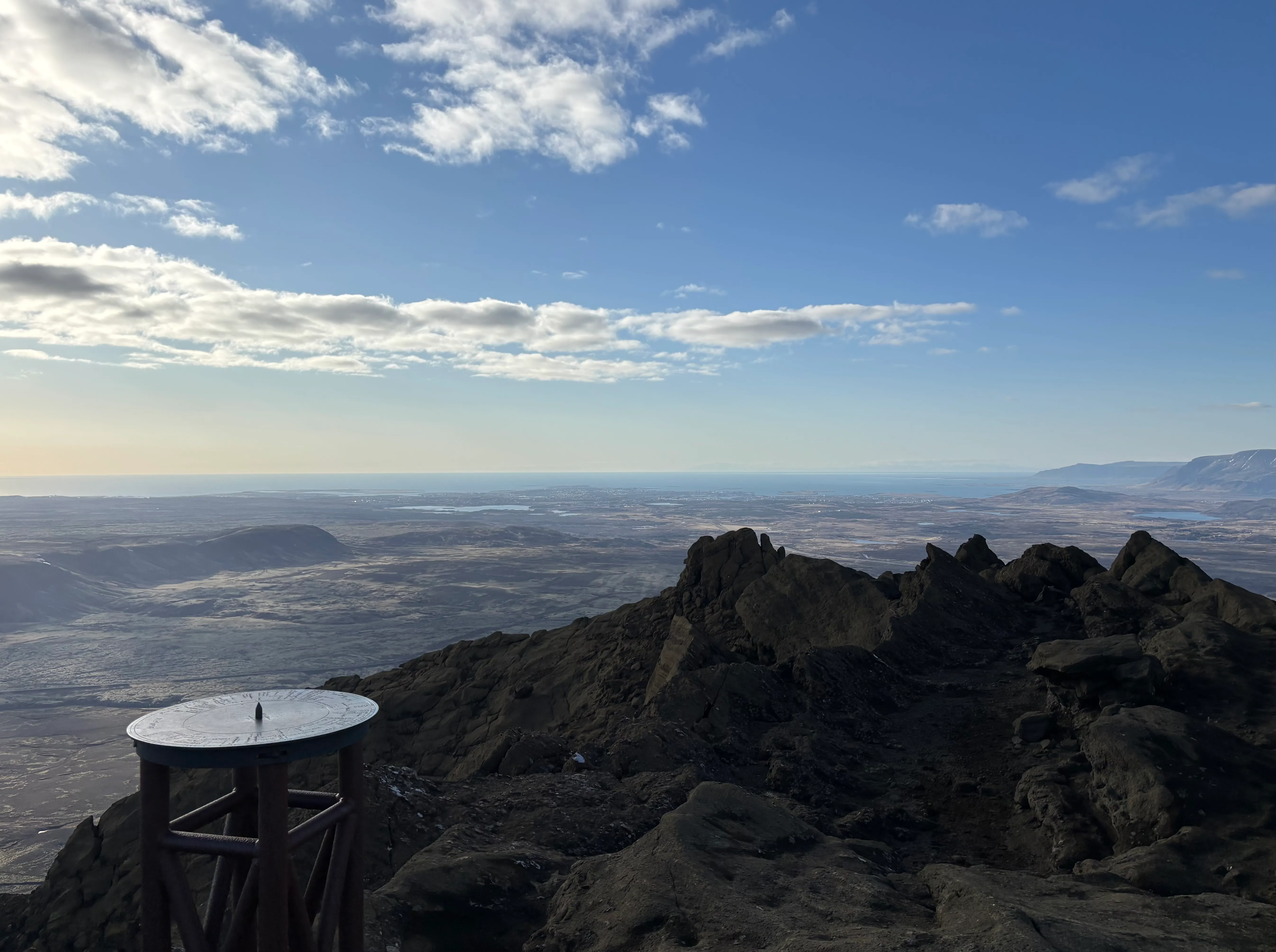 Cloudy day on Vifilsfell
Navigation becomes significantly less straightforward—and potentially dangerous—if fog or low clouds roll in, which is common. Physical maps or offline downloaded maps are essential since cellular service can be spotty on the rugged slopes.
Difficulty Level and Suitability
Challenges Along the Trail
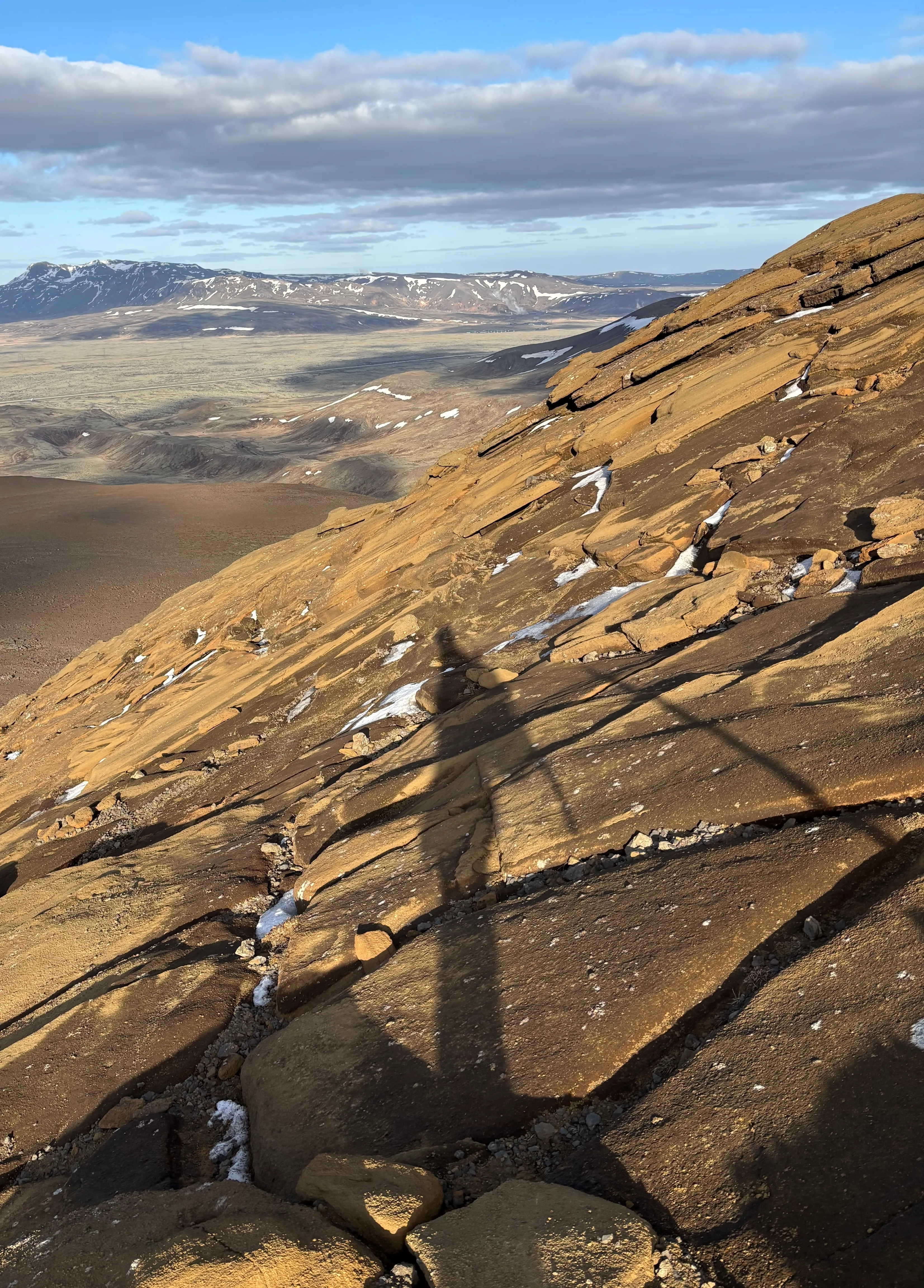 Looking down the steep rocky slopes of Vifisfell
Vífilsfell is considered a challenging hike due to its steepness and the nature of the terrain. The greatest physical challenge begins about halfway up when the gradient sharply increases. Here, hikers face loose scree and gravel, which makes finding secure footing difficult, especially during the descent.
Additionally, the mountain is highly exposed. As you ascend the ridge and approach the summit, wind speeds can intensify significantly, and there is little to no shelter. Given the rapid elevation gain over a relatively short distance, pacing yourself and managing fatigue is crucial to safely complete the hike.
The final stretch before the summit contains installed ropes that you need to use. This doesn’t require any special equipment but can be scary for some people.
Seasons and Weather Conditions
Best Seasons for the Vifilsfell Hike
The most favorable season for hiking Vífilsfell is summer, specifically from late May through September. During this time, the trail is mostly free of snow and ice, offering the safest conditions for the steep ascent.
Spring and autumn are transitional periods. The trail can be muddy and slippery as the snow thaws, and early frosts can make the rocky sections treacherous.
Winter hiking on Vífilsfell should only be attempted by experienced mountaineers. The steep slopes become dangerously icy, and an ice axe, crampons, and specialized training are absolute requirements due to the high risk of slipping.
Weather Conditions
The weather in the Capital Area can change rapidly, and this is especially true on an exposed peak like Vífilsfell. You might start your hike in sunshine and encounter severe wind and fog near the summit.
Wind, rain, and fog are the primary factors to monitor. High winds can make traversing the narrow, steep ridges unsafe, and fog can completely obscure your vision, making navigation impossible. It is critical to check the local weather forecasts (vedur.is) and ensure conditions remain stable throughout your planned hiking window.
If in doubt, it’s better to turn back. The Vífilsfell hike gets progressively hard all the way to the top.
Trail Conditions by Season
Trail surfaces vary wildly depending on the time of year. In the dry summer months, the main hazard is the loose, dry palagonite rock and scree that shifts underfoot.
During the spring thaw, sections of the trail turn into deep mud, making it incredibly slippery and exhausting. In colder months, snow and hard ice cover the upper slopes, requiring technical gear. For a safe and enjoyable hike, the optimal conditions are dry, relatively calm days in mid-summer when the path is solid and visibility is clear.
Equipment and Gear Recommendations
Essential Hiking Gear
Because of the rocky, uneven volcanic terrain, sturdy hiking boots with excellent ankle support and deep treads are mandatory—trail running shoes or sneakers will not suffice on the loose scree.
Iceland’s unpredictable weather necessitates a layered clothing strategy. Start with a moisture-wicking base layer, add an insulating mid-layer, and always carry a high-quality waterproof and windproof outer shell, even on sunny days.
Trekking poles are highly recommended. They provide essential stability on the steep, loose sections, both when climbing up and especially to save your knees on the way down. However, you must have a backpack where you can attach the poles as you’ll need to use both hands on the section with the rope.
Views and Panorama
Summit Views and Panoramic Vistas
Panoramic view from the summit of Vifilsfell
Reaching the summit of Vífilsfell rewards you with some of the most spectacular panoramic views in the region. To the northwest, you get a sprawling view of Reykjavik and the entire Capital Area stretching out to the Atlantic Ocean.
Looking inland, the view reveals a stunning expanse of surrounding mountains, deep valleys, and distant glaciers on a clear day. The contrast of the dark volcanic rock against the green lowlands and blue ocean makes the summit experience incredibly rewarding. The pictures don’t do justice to the view!
Landscape and Scenic Highlights Along the Trail
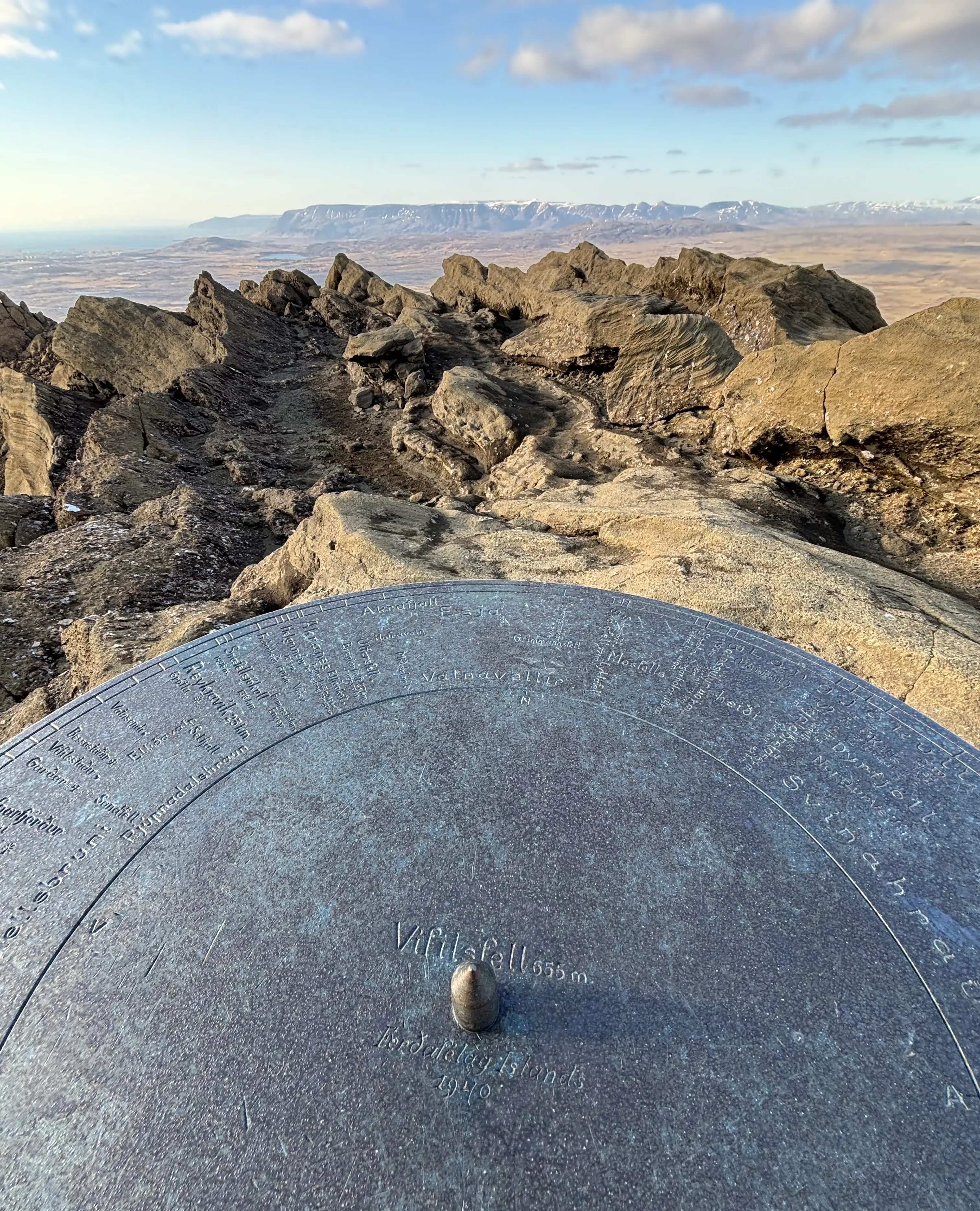 Top dial on Vifilsfell
The scenic experience begins long before the summit. As you approach the mountain, you traverse through fascinating lava fields that starkly contrast with patches of vibrant green moss and vegetation.
Throughout the hike, the ever-present views of Iceland’s volcanic landscape—including craters, tectonic fissures, and rugged palagonite ridges—keep the ascent visually engaging. The changing terrain, from flat scrubland to steep rocky crags, creates a dynamic environment that showcases the raw geological power that shaped Iceland.
Finally, at the top, you can find a dial, installed in 1940 by Férðafélag Íslands (Icelandic Touring Club). The dial points to other nearby mountains and summits. It’s a great spot to take a break, enjoy the views, and plan your next hike!